Dissolving between Land and Sky: Mapping Wendover
Chris Taylor
Land Arts of the American West
The world is blue at its edges and in its depths. This blue is the light that got lost. Light at the blue end of the spectrum does not travel the whole distance from the sun to us. It disperses among the molecules of the air, it scatters in water. Water is colorless, shallow water appears to be the color of whatever lies underneath it, but deep water is full of this scattered light, the purer the water the deeper the blue. The sky is blue for the same reason, but the blue at the horizon, the blue of land that seems to be dissolving into the sky, is a deeper, dreamier, melancholy blue, the blue at the farthest reaches of places where you see for miles, the blue of distance.
-- Rebecca Solnit, A Field Guide for Getting Lost, 29.
01 The blue of distance Rebecca Solnit describes is the place on the edge of perception, a place made as the physics of vision and atmosphere combine. As a measure, this phenomenon of separation can be circumnavigated but never traversed. The horizon recedes with each advancing step as an unattainable threshold. This perceptual ambiguity of dissolution confounds what can be mapped by drawing the geometry of distance within a particular geography. Wendover exists within this inaccessible future—in the blue of distance.
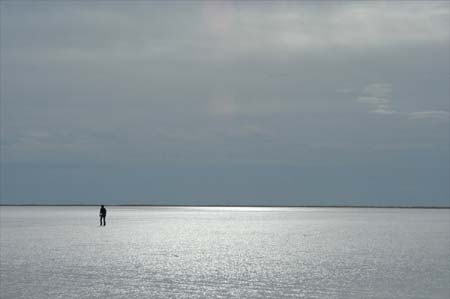
02 A playa is the bottom of a desert basin where evaporation historically exceeds precipitation. Honed flat by winds and the steady polishing of departing water these dry lakes are alluvial collectors of minerals and alkali. Wendover sits on the edge of the Great Salt Lake Desert and near the bottom of prehistoric Lake Bonneville. The salt flats extending north, south, and east of Wendover appear empty, devoid of geographic or cultural features. On such a playa a human figure becomes indistinguishable on the horizon at less than a mile's distance. Author and poet William L. Fox speaks of the human inability to make sense of these isotropic spaces—spaces the same in all directions. Without conventional fore-, mid- and background, the playas of the Great Salt Lake Desert induce cognitive dissonance from this place with little perceptual traction. In fact, without bearings, it is nearly impossible to walk a straight line in this landscape. Yet this landscape of void is anything but empty. It holds traces of human interaction in nearby caves from 11,000 years ago, in the memory of the Donner Party's crossing in 1846, in the land speed records set from the 1930s to 1970s, in the military activity since the Second World War, and in the current industrial uses from mineral extraction to cinematic entertainment.
03 Since 2003, Land Arts of the American West has traveled to Wendover to work on the playa and interact with the Center for Land Use Interpretation at the facilities they maintain on the former air base. Land Arts is a field program exploring the large array of human responses to specific landscapes across a continuum of time. Working in the land and studio, Land Arts extends from geologic forces shaping the ground itself to the cultural actions defining place. Within this context, land art and earthworks include everything from petroglyphs to roads, dwellings, monuments, and traces of those actions. We examine gestures both small and grand, directing our attention from potsherd, cigarette butt, and mark in the sand, to human settlements, monumental artworks, and military-industrial projects like hydroelectric dams and decommissioned airfields. Each year, we travel more than 8,000 miles with fourteen students to live and work for more than fifty days in the landscape of the southwest, visiting a diverse range of sites—Chaco Canyon, Roden Crater, the Grand Canyon, Double Negative, the Wendover Complex of the Center for Land Use Interpretation, the Bonneville Salt Flats, Spiral Jetty, Marfa, Mata Ortiz, the Very Large Array and The Lightning Field.
04 Wendover is a small town at the intersection of Interstate 80 and the border between Utah and Nevada. During the Second World War, the Wendover Army Air Field was one of the largest bomber and gunnery training facilities in the United State, housing upwards of 20,000 people on a base of 668 buildings, and the reach of the installation extended far into the hills and onto the flats. Remote and isolated, Wendover Army Air Field became the ideal spot for Colonel Tibbets to operate in secrecy as he developed and trained for the delivery of the Manahattan Project. Here the 509th Composite Group trained their modified B-29s, including the Enola Gay, before departing for Tinian and then onto Hiroshima and Nagasaki.
05 Wendover is a small city with tremendous visual and political reach. Shortly after the Second World War most of the airfield personnel were relocated and in 1949 the base was inactivated. In 1976 it was declared surplus and released by the military to become a municipal airport. The fallow presence of this place largely abandoned to dissolve into the land and sky. Today only a handful of original buildings remain. The Enola Gay hanger stands as a shell and Colonel Tibbets' office is now privately owned; both are used for storage.
06 There are some, history buffs and veterans, who would like to see Wendover Air Field restored and made into a working museum commemorating the active days of past glory. Most of the recent constructive actions, however, have been connected with the construction of casinos across the Nevada line and the film and advertising industry using the landscape as cinematic backdrop. In the past two decades, West Wendover has grown reciprocally with the entropic erasure of the historic airbase, shifting the presence of the area from near ghost town to functioning ruin.
Mapping Wendover
On Bonneville Salt Flats, Wendover, Utah, 2003, photograph by Chris Taylor.
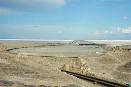
Looking East over Interstate 80, Wendover, Utah, 2003, photograph by Chris Taylor.
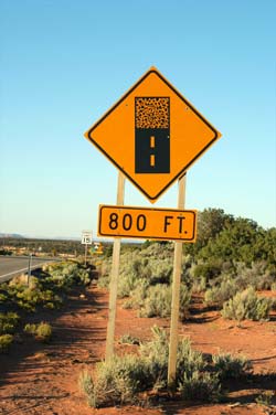
Mineral extraction at Intrepid. Potash, Wendover, Utah, 2003, photograph by Chris Taylor.
Security training remnants at South Base, Wendover, Utah, 2004, photograph by Tracy Stuckey.
End of pavement, near Muley Point, Utah, 2003, photograph by Chris Taylor.
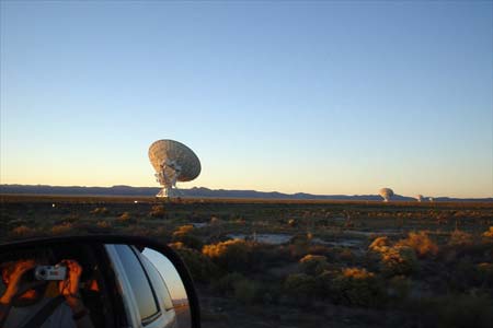
Very Large Array, near Datil, New Mexico, 2003, photograph by Amanda Douberley.
Digging clay from the hills, Mata Ortiz, Mexico, 2003, photograph by Chris Taylor.
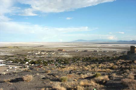
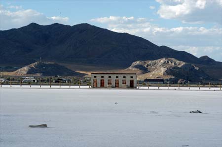
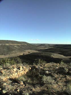
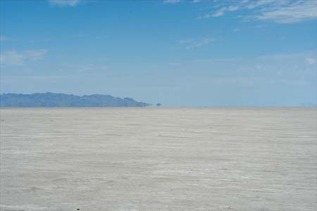
Looking southeast across the Great Salt Lake Desert, Wendover, Utah, 2003, photograph by Chris Taylor.
Munitions storage building, Wendover, Utah, 2005, photograph by Chris Taylor.
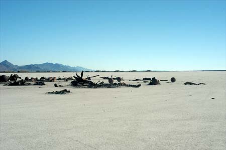
Rocket testing debris, south of Wendover, Utah, 2005, photograph by Chris Taylor.
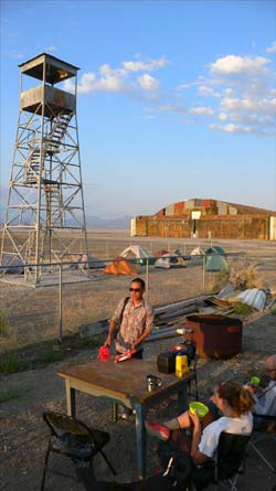
Enola Gay hanger and CLUI observation tower, Wendover, Utah, 2006, photograph by Chris Taylor.
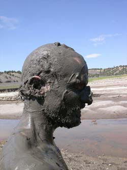
Blake Gibson in the mud, El Vado Lake, New Mexico, 2002, photograph by Chris Taylor.
Traces of settlement, Cebolla Canyon, New Mexico, 2002, photograph by Chris Taylor.
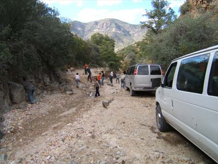
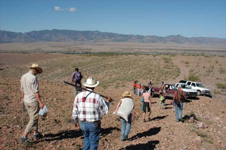
Re-building the road into Turkey Creek.
North of Gila, New Mexico, 2006, photograph by Tanisa Sharif.
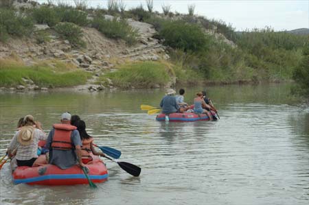
Traveling at the speed of the Rio Grande.
Above Boquillas Canyon, Texas, 2003, photograph by Chris Taylor.
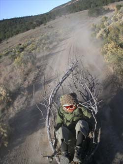
'STX Cruiser 2003' by Gloria Haag.
Cebolla Canyon, New Mexico, 2003, photograph by Gabe Romero.
"Projecting Artlies into the Void", near Deming, New Mexico, 2006, photograph by Chris Taylor.
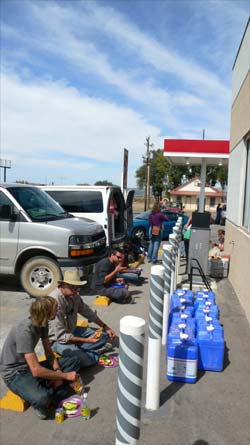
Gas station lunch and water stop, Magdelena, New Mexico, 2006, photograph by Chris Taylor.
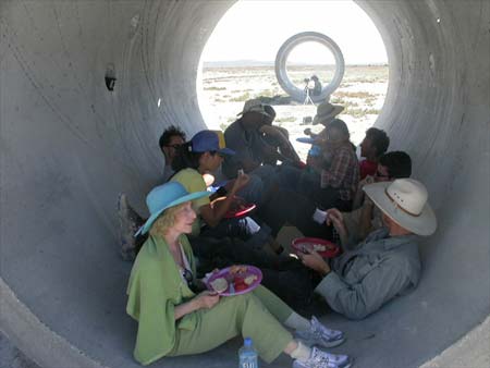
Lunch at 'Sun Tunnels', near Lucin, Utah, 2004, photograph by Beatrice Thomas.
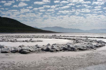
'Spiral Jetty' by Robert Smithson, Rozel Point, Utah, 2004, photograph by Chris Taylor.
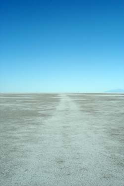
Bonneville Salt Flats, northeast of Wendover, Utah, 2003, photograph by Chris Taylor.
Traces on the playa, south of Wendover, Utah, 2004, photograph by Ben Tremper.
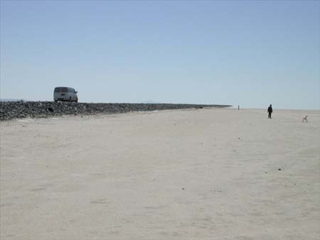
Along Bonneville Dike, northeast of Wendover, Utah, 2004, photograph by Grant Davis.
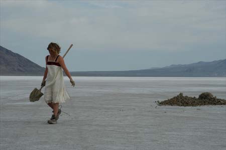
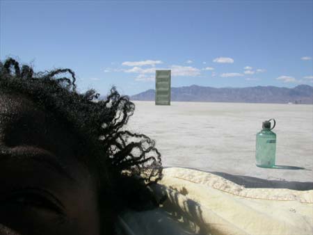
Gloria Haag working in the flats, northeast of Wendover, Utah, 2003, photograph by Chris Taylor.
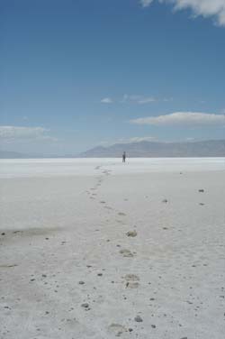
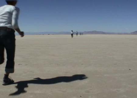
Footprints proving the near impossibility of walking a straight line on the playa.
Bonneville Salt Flats, Utah, 2003, photograph by Bill Gilbert.
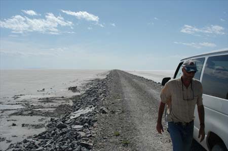
The monumental earthwork Bonneville Dike.
Bonneville Salt Flats, Utah, 2003, photograph by Chris Taylor.
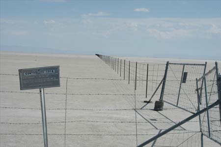
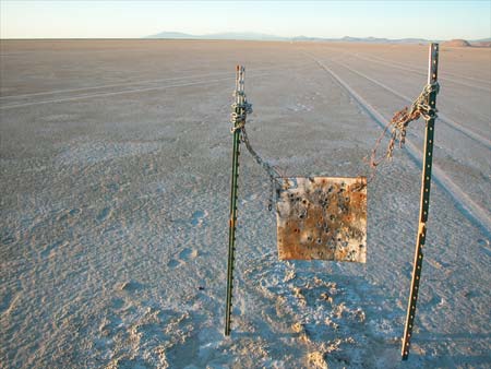
Controlled space of an Air Force boundary, northeast of Wendover, Utah, 2003, photograph by Chris Taylor.
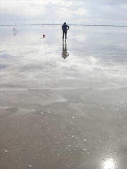
Playa as mirror, Bonneville Salt Flats, Utah, 2004, photograph by Grant Davis.
Trace of a journey, Bonneville Salt Flats, Utah, 2005, photograph by Chris Taylor.
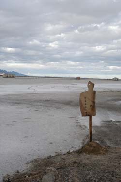
'Visitor' by Ryan Henel, south of Wendover, Utah, 2003, photograph by Chris Taylor.
Working on the playa, Bonneville Salt Flats, Utah, 2004, photograph by Beatrice Thomas.
'Horizon Run' (video still) by Veronica Giavendoni.
Bonneville Salt Flats, Utah, 2004, photograph by Veronica Giavendoni.